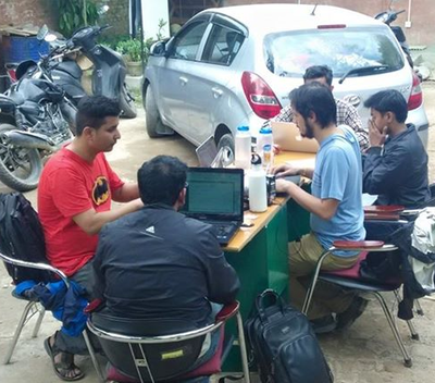
OSM Contributors at Kathmandu Living Labs operational one day after the earthquake
Want to help with relief efforts in Nepal after Saturday’s Magnitude 7.8 earthquake?
In this special WesGIS/Mapping workshop, we’ll introduce tools that you can use to contribute toward relief efforts in Nepal through mapping. We’ll get you registered, provide a hands-on introduction to mapping using OpenStreetMap.org’s browser-based iD editor, and show you how to find lists of mapping tasks that need completion (following the basic outline presented at http://mapgive.state.gov). New satellite images and tasks are being posted daily and there is still much work to be done.
The room has 30 computers. Please bring a laptop if you have one.
When: Friday, May 1, 2:00–3:00 pm
Where: Allbritton 204
Who: Anyone in the Wesleyan community who is interested in helping out by tracing (digitizing) objects from aerial photos. No GIS experience required.
Please RSVP at http://goo.gl/forms/PZwWGMAHIu and spread the word.
Questions? Contact Kim Diver or Phil Resor.


1 comment for “Introduction to OpenStreetMap.org Relief Mapping for Nepal”