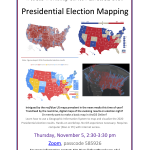
WesGIS Workshop Series / Engage 2020 Event Series: Presidential Election Mapping Intrigued by the red/blue US maps prevalent in the news media this time of year? Transfixed by the real-time, digital maps of the evolving results on election night? Or merely want to make a basic map in ArcGIS Online? Learn how to use…